Hacker Newsnew | past | comments | ask | show | jobs | submitlogin

It's had over a year to drift around from wherever the crash occurred.


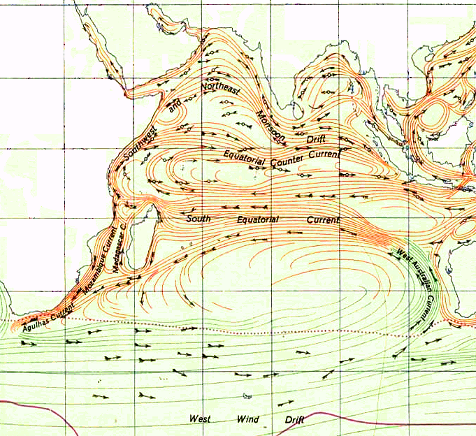
Yup, I was going by the prevailing winds and current arrow on the linked image. But if you superimpose the actual Indian ocean currents (as linked to by goodcanadian)[0], it does make quite a bit of sense.

0. https://upload.wikimedia.org/wikipedia/commons/d/d5/Indian_O...


I combined the images and marked Reunion on the map if anyone is interested. Not a cartographer, so might be slightly off.

http://i.imgur.com/o9qhMyo.png


Here's a really cool site that simulates the drift of plastics in the ocean: http://adrift.org.au

When I pick points in the eastern indian ocean, they all end up hitting africa!


Consider applying for YC's Fall 2026 batch! Applications are open till July 27.

Guidelines | FAQ | Lists | API | Security | Legal | Apply to YC | Contact

Search: